History Day 2010
Mexican Land Grants and the Settlement of Travis County
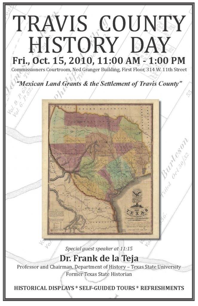
On October 15, 2010, the third annual Travis County History Day was held on the topic of Mexican land grants and the settlement of Travis County. Dr. Frank de la Teja, Professor and Chairman of the Department of History at Texas State University and former Texas State Historian, was the guest speaker. View his presentation in two parts below.
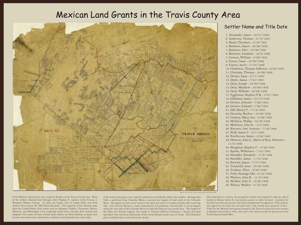
The history of settlement in Travis County far precedes its formal settlement in 1840, to the days of Spanish and Mexican Texas. Mexican land grants record the history of some of the earliest settlers in the Travis County area; many of their names are likely familiar, as the land that they settled became the basis for communities, roadways and landmarks that still exist today (such as Webberville and Del Valle).
Mexican Land Grants in the Travis County area
Origins of Travis County Community, Road, and Landmark Names
- Anderson Mill Road – Named after a mill and its owner, Thomas Anderson, who lived in the vicinity in the 1850s.
- Barton Springs – Named for William Barton, early settler who lived on land near the springs around 1837.
- Burleson Road – Named for early area settler Gen. Edward Burleson, a statesman, surveyor, and soldier in the Texas Revolution army.
- Burnet Road – Likely named for David G. Burnet, interim President of the Republic of Texas in 1836 and 1841.
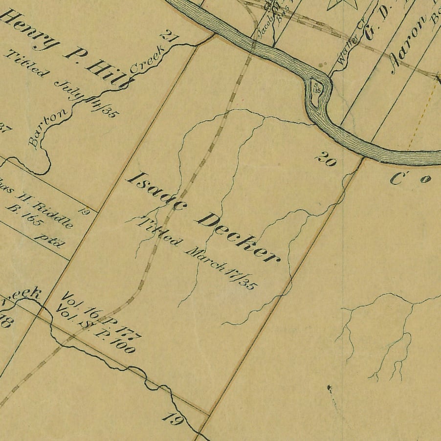
Decker Lane
Named for Isaac Decker, early colonist and shoe cobbler who was granted one league of land in 1835. The league was bordered by the Colorado River at its north end and stretched south to Williamson Creek. Decker and his family did not live in the area for long, as problems with attacking Indians reportedly contributed to his decision to sell his land soon after.
Although Decker’s land grant was located in what is now the south-central part of Travis County, his name is attached to a community and landmarks in the northeastern part of the county. After the Civil War, Swedish immigrants began arriving in Travis County in great numbers and established the communities of New Sweden and Decker. The Decker community, located three miles west of Manor, took its name from Isaac Decker. Decker Lake was constructed in the 1960s and has since been renamed Walter E. Long Lake; Decker Lane still cuts through the rural countryside.
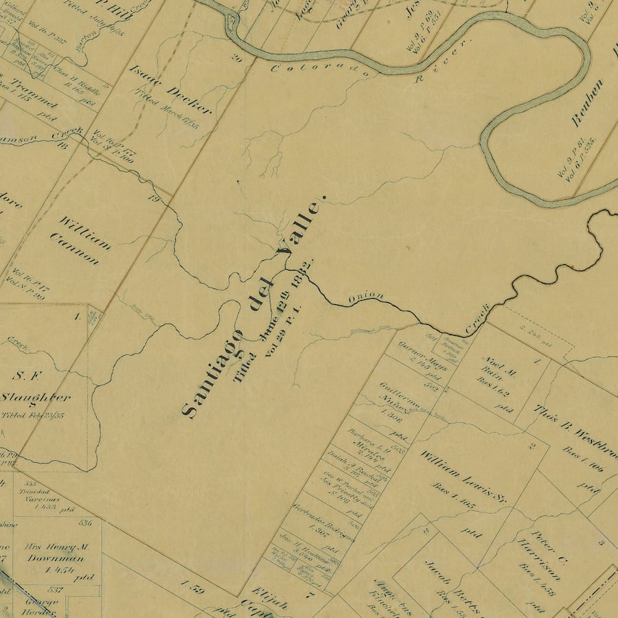
Del Valle
Named for Santiago Del Valle, a politician who received ten leagues of land south of the Colorado River from the Mexican government in 1832. The land was sold soon after, some of which came to be owned by Thomas F. McKinney, one of the original colonists in Stephen F. Austin’s first colony.
The northern part of the Del Valle grant became increasingly urbanized over the years. The community of Del Valle was established in the mid-1870s. A post office opened in 1878, and by the mid-1880s Del Valle also had three churches, two cotton gins, one general store, one steam gristmill, and one school. Del Valle grew significantly in the mid-1900s, aided in part by the opening of Bergstrom Air Force Base in 1942 .
- Enfield – Named by Elisha M. Pease, Governor of Texas, after the town in Connecticut where he was born.
- Hamilton Pool – Named for Morgan C. Hamilton, who owned the property in the 1860s. His brother, Andrew J. Hamilton, was the 10th governor of Texas.
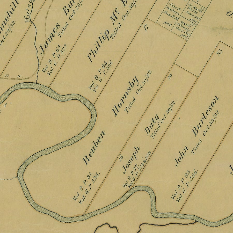
Hornsby Bend
Named for Reuben Hornsby, a soldier, surveyor, and one of Stephen F. Austin’s earliest colonists. Hornsby selected and surveyed his league of land, located on a horseshoe bend of the Colorado River 30 miles north of Bastrop. At the time, his home was the northernmost on the Colorado and therefore the most exposed to Indian raids. Only Josiah Wilbarger, another early settler, preceded Hornsby in settling this extreme frontier.
In 1833, Wilbarger and four companions were attacked by Indians near the site of present-day Austin, and Hornsby rode to his rescue. Hornsby located his severely wounded and scalped neighbor and returned with him to his home. Although Wilbarger never completely recovered from his wounds, he lived for 11 or so more years.
Over the years, Reuben Hornsby built a gristmill, cotton gin, sawmill, blacksmith shop, general store and, eventually, a post office. The area became known as Hornsby Bend, and in 1847, the community built the first school in Travis County, known as the Old Rock Schoolhouse. The first cemetery in Travis County is also located near this community.
- Hudson Bend – Named for Wiley Hudson, an emigrant from Arkansas who secured a land grant in 1854 near a bend of the Colorado River.
- Jollyville Road – Named after John Grey Jolly, a Civil War veteran who farmed, ran a store, and raised a family in the area in the latter part of the 19th century.
- Lamar Boulevard – Named for Mirabeau B. Lamar, president of the Republic of Texas from 1838-1841 and key founder of Austin.
- Manor – Named after Tennessee native James Manor, who followed Sam Houston to Austin and settled in the region east of Austin.
- McKinney Falls State Park – Named for Thomas F. McKinney, trader and stock raiser who purchased part of the Del Valle tract in 1839. The ruins of McKinney’s homestead are preserved in the park.
- Moore’s Crossing – Named for Col. Moore and his family, early area settlers who opened a store there in the late 1800s. The store is still in existence and in operation today.
- Pease Park – Named for Elisha M. Pease, Governor of Texas from 1853-1857 and 1867-1869.
- Pflugerville – Named for Henry Pfluger, who brought his family to the area from Germany in 1849.
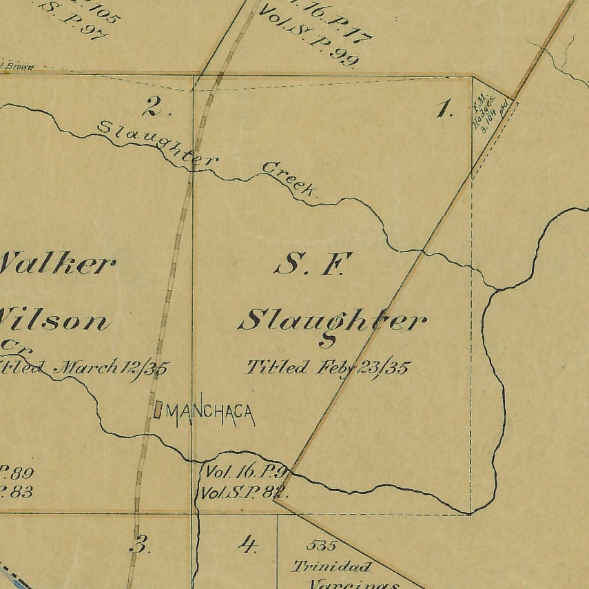
- Slaughter Lane – Named for Stephen F. Slaughter, an early settler from Kentucky who received a land grant for one league of land on Onion Creek in 1835. Very little is known about Stephen F. Slaughter. According to records, Slaughter came from Kentucky at the age of 27. He was a farmer, and he was granted one league of land on Onion Creek in 1835. Slaughter died in 1838; he had four children one of whom married a member of the Eanes family in 1852 and settled on Slaughter Creek.
Waller Creek – Named for Edwin Waller, surveyor of the city of Austin and its first mayor.
Webberville
Named for John F. Webber, who was granted land by the Mexican government in 1832. A retired physician, Webber was the first settler on what would come to be known as Webber’s Prairie, where he built a pioneer cabin on the unsettled prairie. A few other early settlers from Austin’s colonies came to the area soon after, and Webber’s Prairie developed into a sizeable frontier village. As the Indians were driven back and the threat of attack lessened, the area became more appealing to further arrivals.
Although not unprecedented in the early days in pre-annexation Texas, Webber’s family life was atypical. In 1834, after conceiving a child with a slave woman by the name of Silvia Hector, Webber had both mother and child emancipated by their owner and acknowledged them as his family. Over the years, the Webbers had at least eight additional children.
Despite acceptance from some, many of the newer settlers to the area were bitterly opposed to the mixed marriage and set to work to drive Webber out. Eventually, they succeeded. In 1850, Webber sold his lands to Col. John Banks and moved further south. Col. Banks renamed renamed the community Webberville in 1853.
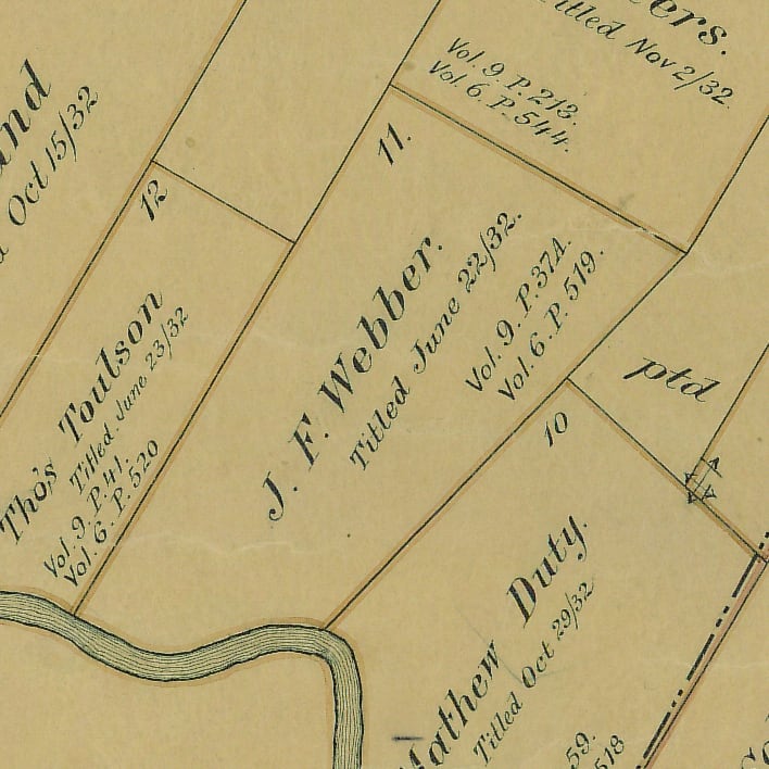
- Wells Branch – Named for Martin Wells, an early settler in Stephen F. Austin’s Little Colony who lived near Webber’s Prairie.
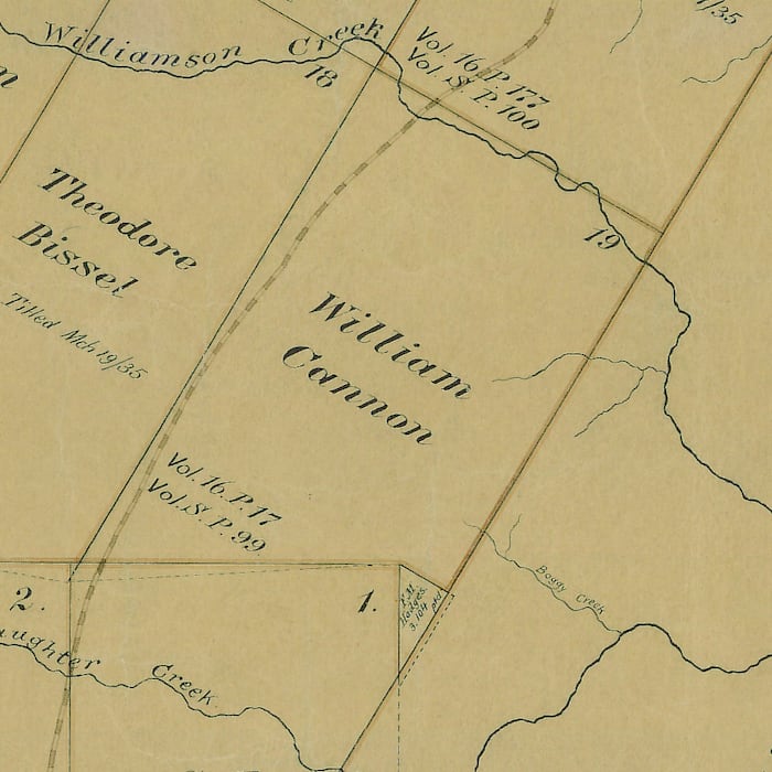
- William Cannon Drive – Named for William Cannon, an early colonist from Ireland who was granted one league of land west of the Colorado River from the Mexican government in 1835. The land stretched from Williamson Creek to Slaughter Creek, south of what is now downtown Austin. He was married twice and had as many as five children, and he enlisted in the military during the Texas Revolution. He remained in Texas following the war and died in Bastrop in 1851.
Zilker Park – Named for political figure and philanthropist Andrew Zilker, who came to Austin in 1876. He was the last private owner of Barton Springs.